Cabarrus County, North Carolina, Plats and Maps
1747-1916
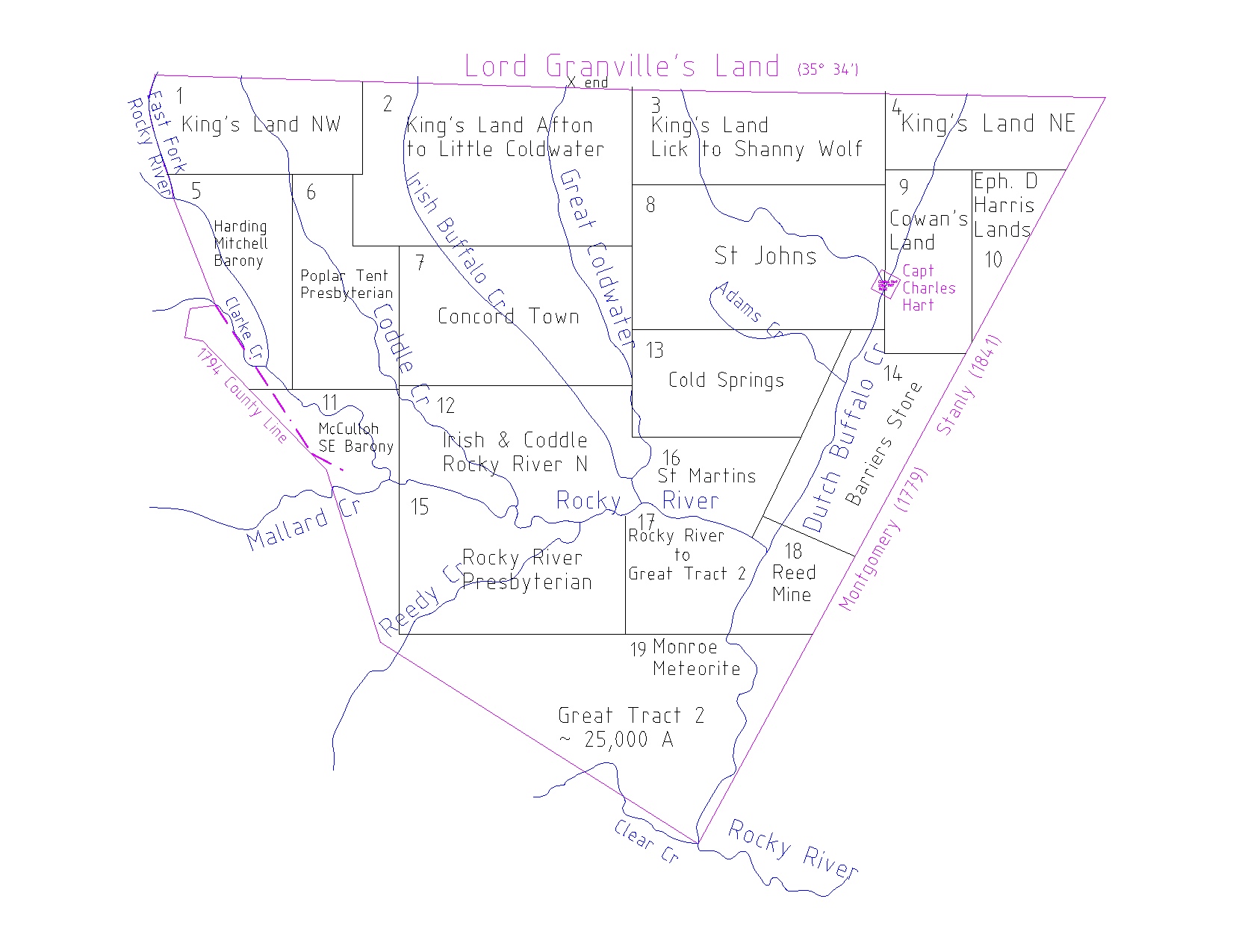
This book contains a brief land history beginining in 1737, when the Crown (King George II) delivered to Murray Crymble and James Huey, trustees for Henry McCulloh, twelve 100,000 acre Great Tracts lying on the waters of the Upper Pee Dee, Cape Fear, and Neuse rivers. Four of these Great Tracts encompassed most of the land that became Cabarrus County, North Carolina. It contains an accurate map of the Great Tracts and nineteen 11" x 17" color maps (~ 8,000 - 12,000 acres each) consisting of approximately 1500 individual plats for grants from the King and State and the wealthy Irishmen and Englishmen who owned the Great Tracts. The maps show the streams and major modern day roads and county boundaries which enables one to fairly accurately locate the original settlers ...."the plantation on which I now live, land lying on the waters of __________ stream..".
The timeline for the formation of Cabarrus County: see NC State Library and Family History .
Bladen was formed from New Hanover in 1734
Anson County from Bladen 1750, between SC and Va to the South Seas
Rowan from Anson 1753 , along Lord Granville's Line ( 350 34' )
Mecklenburg from Anson 1762, by a Line beginning at Lord Carteret's
[Granville's] Line. Six Miles North East from Captain Charles
Hart's plantation on Buffalo Creek, and to run from thence to the
Mouth of Clear Creek which empties itself into Rocky River
Cabarrus from Mecklenburg 1792 : 233,000 acres, 364 sq miles
Publisher:
ABP ABSTRACTS
Bruce Pruitt; Box 815; Whitakers, NC 27891
ABP ABSTRACTS item# 28
A listing of each grantee, the grant # or grantor, the acreage, and the Map# is in the Master Index