Seldom during Colonial and early State mapping was magnetic declination (variation of the compass) taken into account. Fortunately, it appears to have been less than three degrees East during the time interval 1750 to 1850. However, it becomes a problem when placing the original plat drawings onto a modern day map. For example, at 3 degrees and for one mile (80 chains) a lateral error of about 5% or 4 chains occurs. It is a simple matter to rotate the drawings provided one knows the magnetic declination at the place and time. |
|
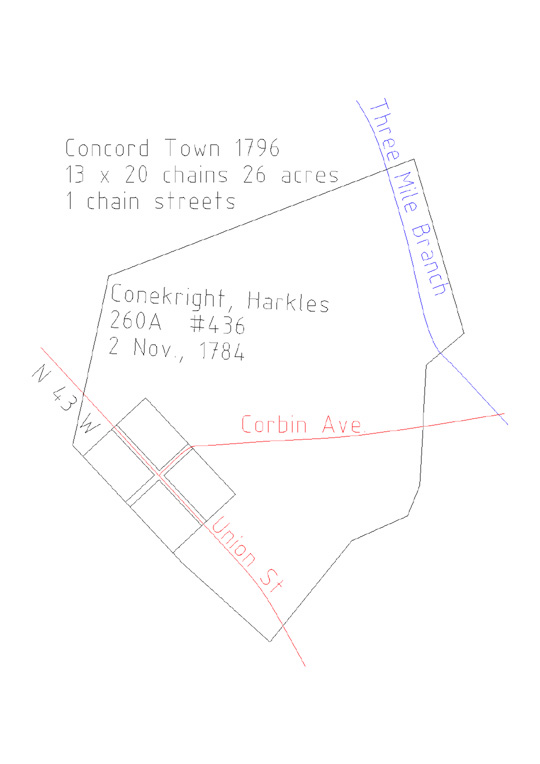
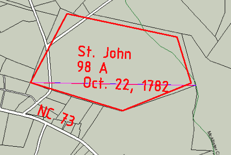
There are few known historic survey lines in Cabarrus County. Union St in downtown Concord followed the Harkles Conekright #436 1784 land grant on the south west border running at N 46 W. From the USGS Topo maps it runs at about N 43 W giving a magnetic declination of about 3 degrees east in 1784. This is in agreement with the NOAA data. St. John's Lutheran Church still has its original 98 acre #189 1782 land grant. It has "grown" slightly to 106 acres but still retains the same shape. Rotating the old plat 3 degrees easterly produces a moderately good fit to a current county GIS map! The early maps of Mecklenburg show the eastern border with Montgomery running at S 25 W to S 26 W from the Rowan County line to the mouth of Clear Creek at Rocky River. On modern day maps the border runs at about S 28 W . |
Concord Town rotated 3 degrees east