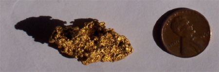
| Gold from Plum Run |
|
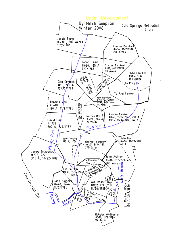
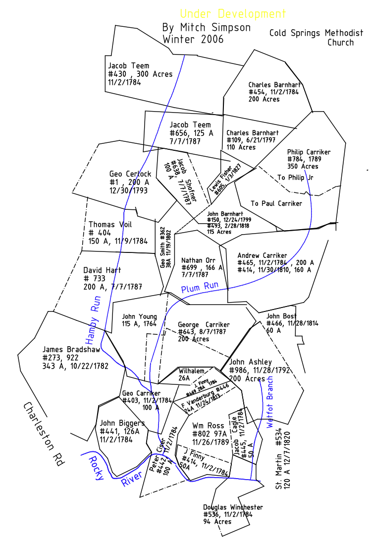
Cabarrus Land History, Book of Maps 1747-1916 by Drs. H. Mitchel Simpson and A. B. Pruitt
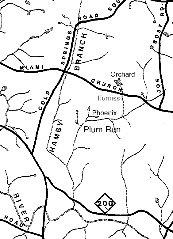
The Charles Barnhart lands ( 1784 - 1810) just south of Cold Springs Methodist Church, Cabarrus County, NC Hamby Branch andPlum Run showing the Phoenix, Furniss and Orchard/Boger mines. |
| The first (11/16/1764) deeded land along Plum Run and Hamby: |
| Royal Governor..... His Excellancy, Arthur Dobbs Esquire, Captain General, Governor and Commander in Chief of the Province of North Carolina and Justina his wife .....to John Young of Mecklenburg County, North Carolina ...... a tract or parcel of land containing 115 acres "Lying in ye fork of Plum Branch and Hamby's Run the waters of Rockey or Johnston's River" |
| Lands lying on the waters of Plum Run: (small)..... Large A late 1700's, early 1800's map (PDF) of Land Grants for this area of Cabarrus County, North Carolina. Cabarrus was formed from Mecklenburg in 1792. Deeds and Land Grants prior to that date were in Mecklenburg County. There were no grants in this area prior to 1762 when Mecklenburg was formed from Anson County. |
Metes and Bounds, Distance and Bearings: A simple deed plotter
Topozone Map @ lat=35.33472&lon=-80.50722
A quote from the 1854 Hodge Report concerning the Furniss Mine Lands:
" On the other side the property, bordering the Phoenix Company's tract, the
same vein (probably) out-crops on a little brook, called Monkey Branch. Both
gold and copper ores are found loose in the banks of the stream; and,
notwithstanding the prohibition of the former proprietor, the place has been
with some a favorite resort after freshets for collecting little
"nuggets" of gold. "
Monkey Branch and Plum Run showing the Phoenix, Furniss and Orchard mines.
Mitch Simpson ![]()